Sports
Cedar Creek Falls — a Summer Place
The hike is strenuous and steep in places but it offers a waterfall and pool, shade trees and views that will interest geology hobbyists.


Update: 2011
from the Ramona side due to It is due to re-open summer 2012. The Eagle Peak side of the Falls, from Julian, is open again. The Forest Service is considering issuing a permit system when the Ramona side re-opens.
*******
Find out what's happening in Ramonawith free, real-time updates from Patch.
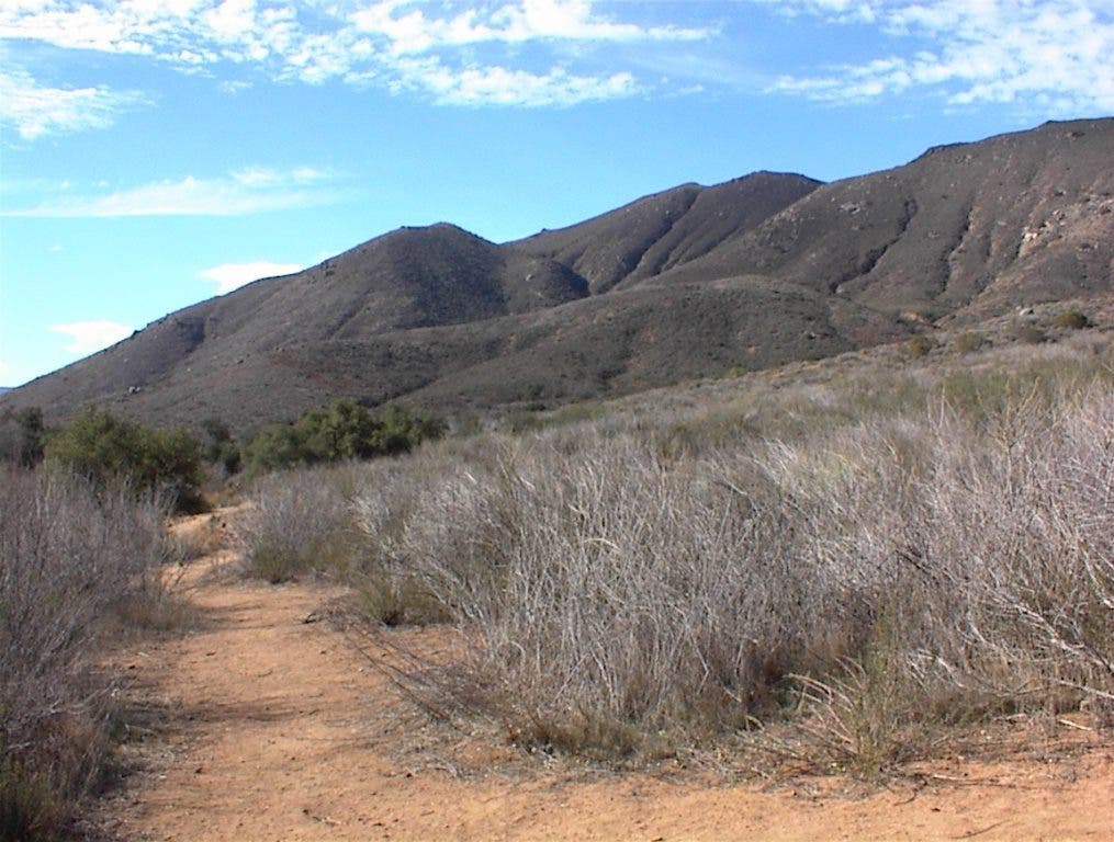
Cedar Creek Falls is one of the signature hikes of San Diego County's backcountry. It is widely known and popular any day of the year. The trail is at the far east end of the San Diego Country Estates in Ramona, off the end of Ramona Oaks Road.
The drive down Ramona Oaks gives one a dynamic view of the southern flank of Mt. Gower. The trail starts at the south end of Thornbush Road, by the water tower in the Cleveland National Forest. At the trailhead there is parking, with a small sign marking the boundary of the National Forest and the Estates. Be sure to park in the National Forest and not in the Estates homes area.
Find out what's happening in Ramonawith free, real-time updates from Patch.
Cedar Creek is a robust hike with some steep terrain on the way down to the bottom of the San Diego River canyon. There is now a nice trailhead and erosion control on the arroyos crossing it. Take plenty of water and be ready for a hike of up to 2 ½ hours, round trip. The trailhead is at 1,964 feet and it drops down to about 900 feet in elevation at the San Diego River. Then it climbs back up another 500 feet to Cedar Creek, which is at 1,400 feet. While the way down is steep, it's not too bad of a workout. However, the way back up can be strenuous for some people.
Google maps can give you a satellite or topographic map of the area before you go. Google Earth is another good resource. Both applications are free utilities on the Internet.
The trail leads over the crest of the canyon wall for about ½ mile and then begins a steeper and steeper descent. As you cross the upper plateau you will see a lot of quartz and pegmatite “float” exposed on the surface. It is called float because it floats to the surface from erosion of the surrounding clay.
The trail comes up on a small ridge about halfway down that gives a good overlook from midway down the canyon wall. Passing by the granite boulders you can see they are laced with Xenolithic hematite spots. These black spots are mantle rock, which is high in iron. It mixed in the granite reaction zone as it was forming and was frozen in place when the granite cooled before it had melted and reacted with the granitic mix. As you reach the canyon bottom, the view up the canyon walls is very dramatic on all sides. As you get closer to the river, there is more green vegetation and some flowers.
You have to cross the river. Do be careful on days that have flash flood watch. These steep canyon rivers can swell very quickly with rain. There is a trail through the oaks and up the access road for Mount Helix Water District. Continue across the road heading along the trail up the side branch creek to the east. You hike up this creek about another ½ mile into the canyon beside Eagle Peak. Again, the views are very dramatic, with steep canyon walls all around. There is greenery and there are flowers all around as you approach the canyon bottom at the river. You have to hike over the creek and around and through boulders that get bigger as you get closer to the falls. It is a good, fun workout climbing around the boulder to get to the Cedar Falls water pool.
Cedar Falls is usually flowing, with the flow being heavier in winter and rainy seasons. After the Cedar Fire in 2003 the pool at the bottom was filled with sediment that ran off the upper plateau with the winter rains. You could actually walk out to the Falls face and touch it. Now it’s a fairly deep pool. A few folks enjoy swimming in the pool. Diving from the cliffs here is VERY dangerous. Almost every year, at least one person is pulled out of here for breaking their necks diving in or from heat exhaustion.
The pool at the falls bottom is fairly clear most of the time and gives interesting reflections and which help light up around the pool. The surrounding hills and trees make this a cool respite on hot summer days, even if it’s a good workout to get back up to your car.
Fires are prohibited down there for good reason. The fires can quickly spread up the hills sides and certainly outrun you up the hills on windy days.
If you go:
Directions: 8 miles west from downtown Ramona on San Vicente Road, past the San Vicente Clubhouse, turn left on Ramona Oaks Road. Travel about 4 miles and when you get to Thornbush Road turn right and go up the hill to the water tower. Parking is at the top of the hill.
Difficulty level: moderate with some steep and slippery spots on inclines. The trail can be hot in summer, so plan morning hikes then.
Parking: There is public parking at the road end near the water tower. Park at your own risk. Be sure to hide anything of value and lock up tight.
Facilities: Toilets are at the trailhead and will be finished and usable after April. Dogs allowed on leash. No fires or camping.
GPS: Latitude: 33.021775 Longitude: -116.733171
Elevations: San Diego River — 900 feet; parking lot — 1964 feet; delta — 1100 feet; Cedar Creek Falls — 1400 feet
Tail length: 4.5 miles round rip


